
Our recent trip to Tenerife was not a new idea, as I was checking Mt Teide as soon as we returned from Japan and our hike to Mt Fuji. Back then, it was still just the two of us and things were slightly different. This time I did my best trying to organize everything to get me to the top of Mt Teide, but all the forces were against me. Even the lame option to get there with funicular and see the view from that magnificent mountain was cancelled when we were already on the road towards it.
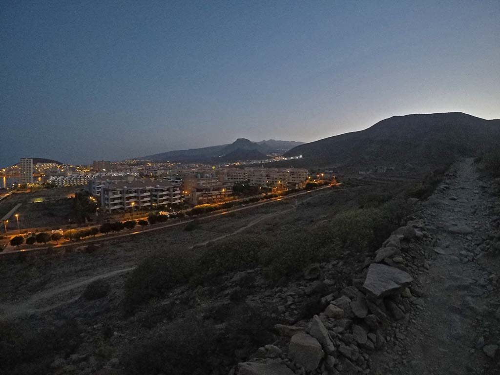
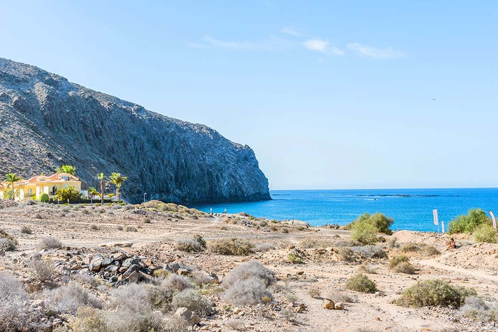
Since from the beginning it all looked like I will not get a chance to climb it, I was looking for some backup options. Accidentally, one of them was a mountain “Montana de Guaza” in Los Cristianos. When Dina found the AirBnB apartment we didn’t even figure out that we’ll be situated in the last row of houses in town, and that the hiking trail towards the top of Montana de Guaza will be literally just across the road from us.
Even though it’s a relatively small mountain (with altitude of only 428 meters) info on the Internet stated that it’s among medium or hard mountains to climb, and that it takes around 1 hour 30 minutes to get to the top. I watched the mountain from the apartment and told Dina that it depends how hard the first and very steep part will be, but that my estimation is 20 minutes to get to the top of the plateau visible from our balcony. If I’ll need more than 20 minutes, I’ll come back straight away and it will be a short walk, otherwise I’ll try to get to the top of Guaza mountain.
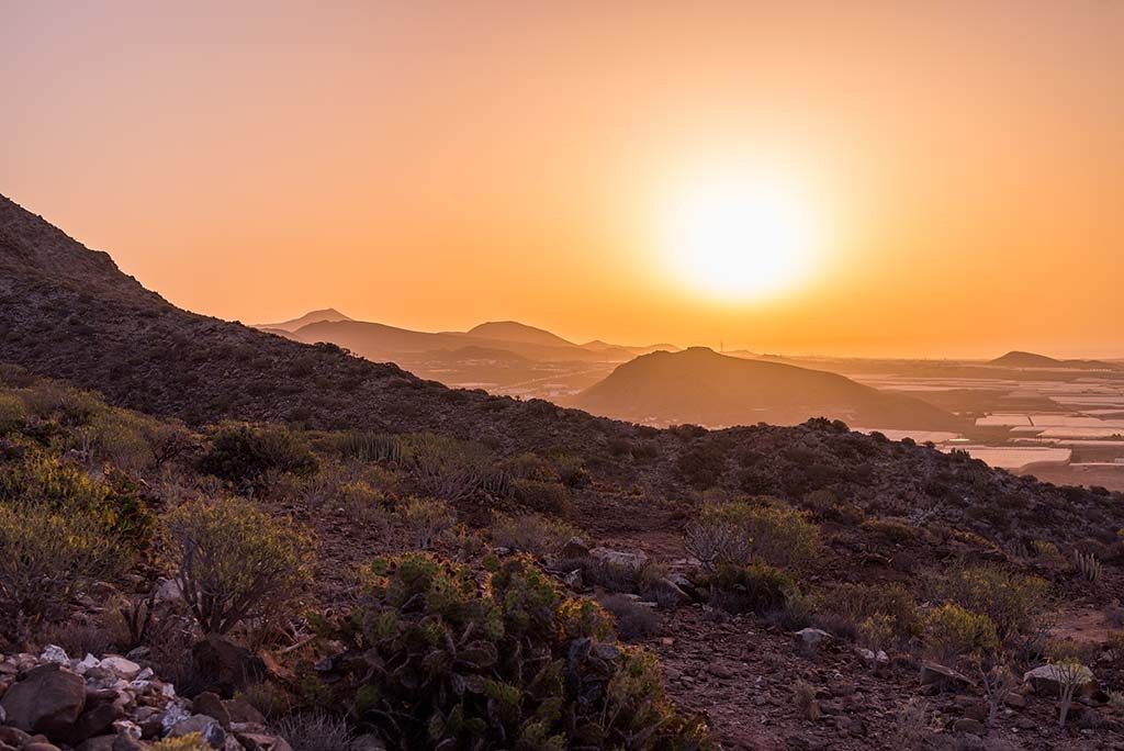
I started around 7.20 in the morning as soon as it started to get a bit brighter. Well, I got up 6.00 and planned to go there straight away, but it was still pitch black on Tenerife, and I really did not want to break any of my bones. 🙂
With a couple of photos taken and a short video, I’ve reached that first milestone in 11 minutes. That was a clear sign that I should be able to get to the top and back in less than 3 hours.
Although it was so early in the morning, I was not alone on the mountain. In fact, two guys surpassed me as they were running all the way up. Trail consists of three segments. First steep narrow road to the top of the first plateau, where you can’t really miss a lot. Second part is the plateau plain itself, which is crossed with numerous paths going around once cultivated parts of the mountain. That part is tricky as there are no signs, and you can easily roam around for a while, especially if it’s cloudy or foggy and you don’t see the top. And then third part which is actually a very steep rocky road all the way to the top where GSM and other antennas are located.
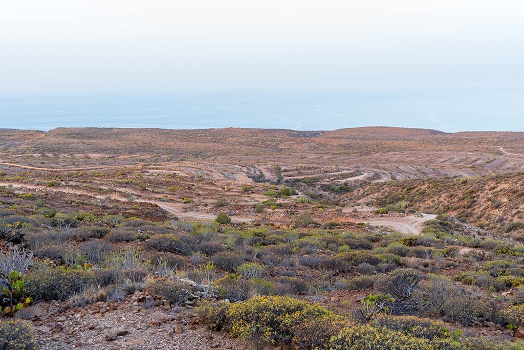
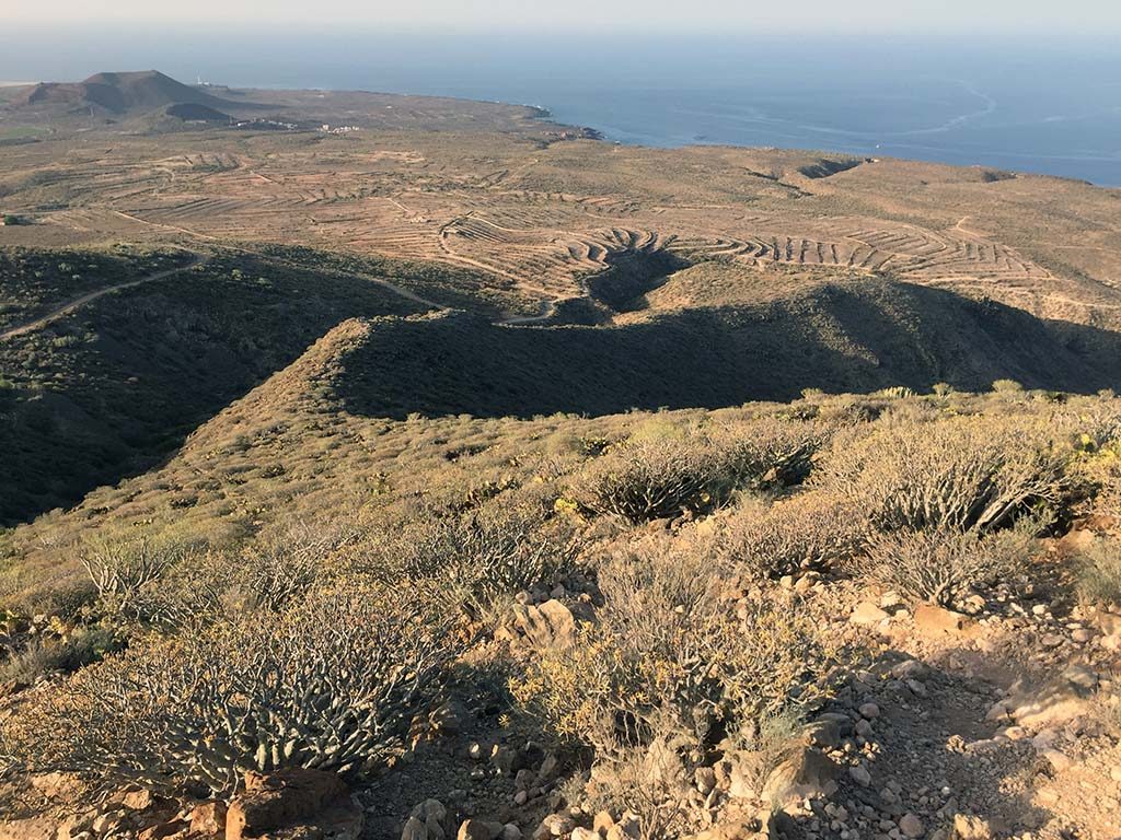
The mountain is of volcanic origin and since it’s quite warm and with scarce of rain, soil is quite dusty and soft, so it’s easy enough to slip and fall especially going downwards. Vegetation is mountain specific, with several types of cactus plants and other small bushes and shrubs, so quite different than anything I hiked so far.
Mt Guaza was considered saint by Guanches, who were the original Aboriginal population on the island before Spanish conquered them in 1496. Because of that and the fact that gray crane and yellow-legged gull nest here, the mountain is declared as a Natural Place of National Interest in 1984, and in 1994 it was reclassified as a Natural Monument.
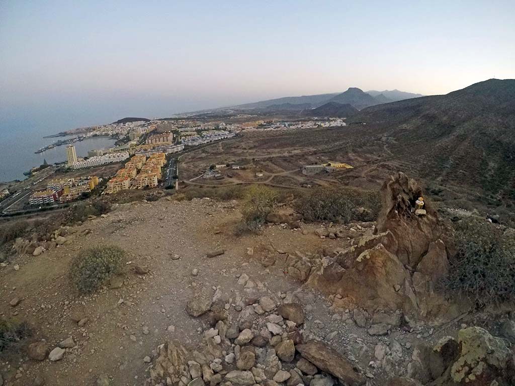
From the top you can see three places surrounding the mountain. Los Cristianos on the west side, Guaza on the east and Palm-Mar on the south, and you can enjoy the magnificent view towards Mt. Teide on the north.
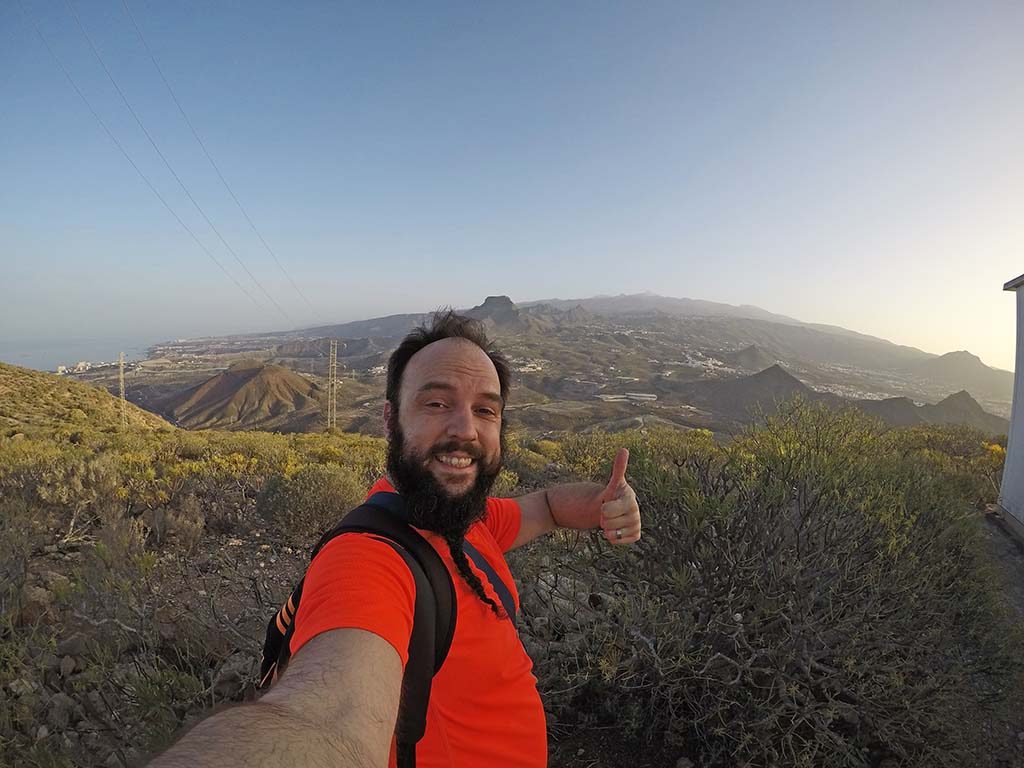
I needed one hour and for minutes to reach the top, and somewhere around that time those two guys that surpassed me saluted me again, they were already on the way down. It’s not strictly because of them, but for some strange reason I don’t like running on the regular road, but I do like to run up the hill, so I ran a bit too. That might be the reason for such a good time needed to reach the top. 🙂
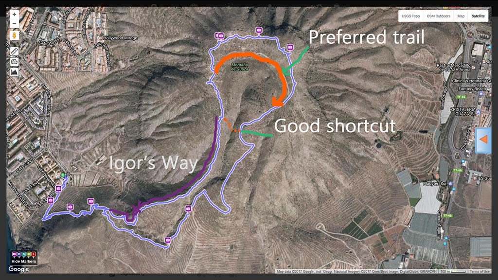
As well, it might be the reason I was too comfy and I decided to “take Igor’s shortcut” on the way down. That being said, I picked the side from which I could see our apartment at all times, and thought that it will bring me exactly where I started my hike. Errrr, wrong! This mountain is built of a couple of hills, that are practically separated with a gorge, so going “my way” means you’ll end up walking between the cactuses and quite big sharp rocks on the ridge and then descent into a gorge. And those rocks wish to help you going down. Yep, they roll and you’ll most likely slide or/and fall down, which in proximity with huge cactuses is not a pleasant thing to do.
At one certain point both of my legs decided to go way ahead of the rest of my body, but luckily there were two solid rocks that I grasped frantically, and somehow managed to stop my body from falling or sliding. I was surprised by the move that looked like Cruise’s scene from “Mission Impossible”, but I guess I’m still not that old. 🙂
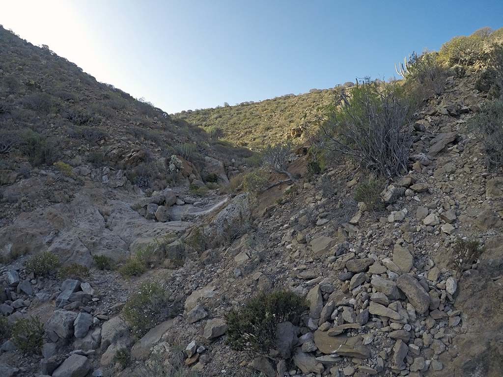
I ended up in the dried gorge and followed the path that brought me to the top of the cliff. There were two paths available – have a para-glide and jump from the cliff, return up the hill and all the way back – which would take me an hour. Well, stubborn as I am, and with recent fall just a few minutes ago I decided to find a third one and I climbed, now the almost vertical, hill in front of me once again. Luckily, there were some dry plants and solid rocks, so with a bit of luck I managed to get back to the original path and safely end my short but intense adventure.
It’s been the first hill in a year and a half, and I really needed it. Hopefully I will not wait that long again for the next hike. 🙂
Till the next post.
Kisses,
Balky
You must be logged in to post a comment.